120km Through Patagonia - The O Circuit
'An 8 Day Stroll Around Torres Del Paine'
THE RECCE FILES
Joe Browne
2/14/202615 min read

Location:
Torres Del Paine, Chilean Patagonia
Dates of Trek
18th-25th December 2024
Distance Hiked
105km - 5,400m elevation gain
Where to begin...
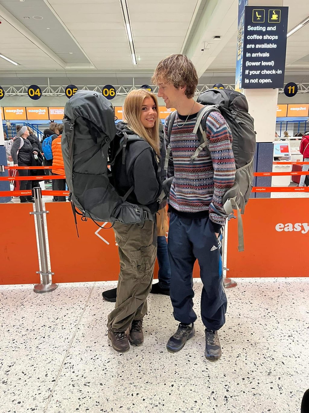
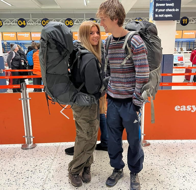
After returning from a one month solo trip to Vietnam, my girlfriend Rose and I decided to go and backpack around South America for four months. We had the plan to start in Patagonia, and work our way north, through Argentina, up to Bolivia and eventually Peru. We went without any real plan in terms of places to visit, other than a 14 page google doc my brother's boyfriend had made, detailing all of the places he went on his six month trip. This came in very handy at points.
The only thing we had pre-booked was the O Trek. One of, if not the most famous trekking circuit in Patagonia. We left it quite late to book, only six weeks before going, so we were very lucky to manage to find availability, particular for mid December. Peak season is from December to February, but trying to secure accommodation for any of the months the park is open (October to April) can be a real challenge.
To save money, we booked self pitch accommodation for each night it was available (4/7) and equipped tents for the other three nights. We also opted to carry a stove and all food for the 8 days, to save on meal costs.
Puerto Natales...
We had a few days in Puerto Natales (the nearest town to Torres Del Paine) pre-trek, where we planned to do a few warm-up hikes and explore the local area. A couple of wild swims, a cinema trip to watch Gladiator 2, and a two night camping trip to Pingo Salvaje, a really nice ranch with a campsite, around 30 minutes north of Puerto Natales. We spent two nights here for Rose's birthday, a really peaceful way to spend it.
From here, we hiked up Cerro Mocho, a 1,450m mountain. This ended up being impossible to find the paths for. They had ribbons on trees to signpost the trails, which seemed to stop every few hundred metres. We ended up making it to the summit, exposed to strong winds, but with 360º views of mountains, the Southern Ice Field, the Patagonian steppe and Torres Del Paine to the north. A really cool experience, and just as confusing to get down from.
The day after, we went for a shorter walk, to see some waterfalls and caves. around half way we heard an animal start shrieking at us, uphill but not too far away. From a distance I thought it was a fox, which isn't worrying, but knowing the puma population in the area, and the threatening sound of the noise, we decided it was best to turn around and get back to the camp site as quickly as possible. Having searched it after, I think it was a fox, and it was probably trying to keep us away from its puppies. Probably the right decision.
Tip: If you are looking for a cheap, outdoorsy hostel with really helpful staff, then look to stay at Red Point Patagonia. Lots of people stay here as a base to go climbing and trekking, it has a bouldering and climbing wall in the hostel. You can also rent any gear needed for the O/W Trek here too. Note, you can only pay in cash.
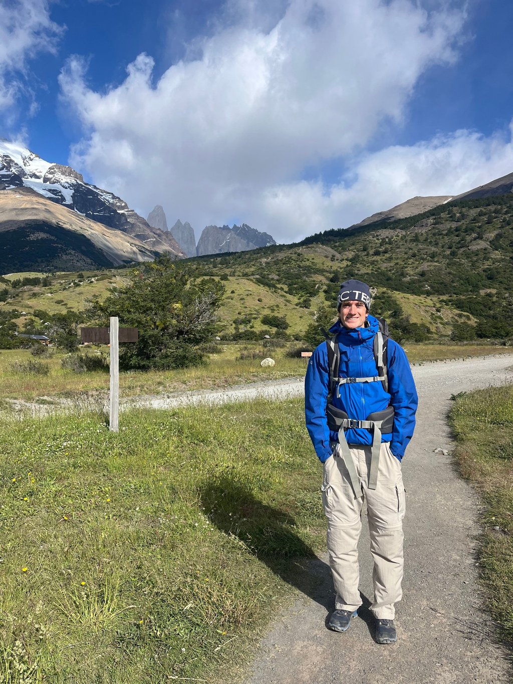
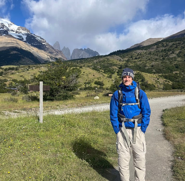
Day 1 (Central to Seron)
The first day of the O Trek arrived. We woke up early, ate some porridge and left the hostel. A 7am bus was in store to get us to 'Central', the main entrance and start of our O Circuit route, at around 9:30am. Note, to get here, get a bus to Laguna Amarga, then you need to get a shuttle bus to Central. This costs $5,000 CLP (as of writing), and needs to be paid in cash.
Today was quite a short day, 13km with 350m of elevation gain. This was the perfect day to get the trek started, all on nice stable terrain, not too hilly. But very windy. There were a few times we were almost blown off our feet. I think if we jumped, we'd have ended up about 20 metres behind us.
A nice lunch break by Rio Paine, equipped with pre made sandwiches and some knock off snickers bars. The water was a solid light blue colour. I have never seen rivers and lakes like those in Patagonia. The colours are out of this world.
We made it to camp early afternoon, interested to see the semi-equipped tent had in store. They are raised off the ground, with a ladder up to the entrance. Almost like a TentBox without a car underneath. They're very spacious though.
Seron isn't much to write home about. There's an indoor area, which you'll be asked to leave at meal times if you haven't booked meals. The only other communal area is in a large tent outside, where you can cook meals on a stove on picnic benches. It was also freezing in there. An early night it was, ready for day two of hiking tomorrow.
Tip: If you feel you can, it is possible to skip Seron and hike straight to Dickson on Day 1. This would mean a long, 32km day. But will save you a decent chunk of money.
Day 2 (Seron to Dickson)
After a very cold nights sleep, we woke early to make some oats in the freezing cooking tent. Apparently it had been -7ºC the previous night, and our sleeping bags were rated to 0ºC comfort. This was enough for most other nights but the first night had been really cold.
After some oats and an instant coffee, we packed our bags and went on our way. It was a nice crisp morning, sun shining, and you could see fresh snow resting on top of the surrounding mountains from the previous night.
Today had around 18km and 500m of elevation gain in store. Getting into some longer mileage. Again, fairly relaxed compared to what was to come. It was all nice trails, some flat sections of fields, some steep hills and a lot of wind. My buff was essential to make sure my nose didn't feel as though it could snap off if someone flicked it.
These sectors exclusive to the O Circuit are more remote than all of the W Trek sections. The north side of the park, where the O Circuit goes, is limited to 80 people per day. It's by no means quiet, but if you leave early you're likely to only see a handful of people by the time you get to camp. You can only go clockwise too, meaning there isn't traffic going both ways, unlike on the W, which can get congested.
That was the case today, we'd only seen three or four others whilst we had snack and lunch breaks. For me, this makes the views even more special. There isn't much better than staring at a mountain with no one else in sight.
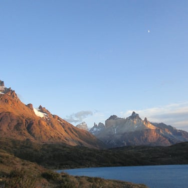
We arrived at camp early-mid afternoon, and set our tent up. There were a few spots of rain in the air, which was on and off for the rest of the evening. Through the trees behind the campsite, you will find a beach on the shore of Lago Dickson, a glacial lake, partly in Chile and partly in Argentina. As little as 30 years ago, this lake was purely in Chile, but due to climate change, the Dickson Glacier has retreated significantly, expanding the area of the lake across the border.
Campamento Dickson has a nice indoor cooking area, where a lot of hikers sit and socialise. It was nice to meet a lot of people here. We started to see some faces we hadn't seen the previous night, people who had skipped Seron, and gone straight to Dickson.
Day 3 (Dickson to Los Perros)
A warmer night meant a better sleep. And another early start with oats and Dulce de Leche, something I had never had but seemed to be very popular in Patagonian supermarkets. It was definitely a good addition to the porridge, giving us some fuel for the legs. Pure sugar to the muscles.
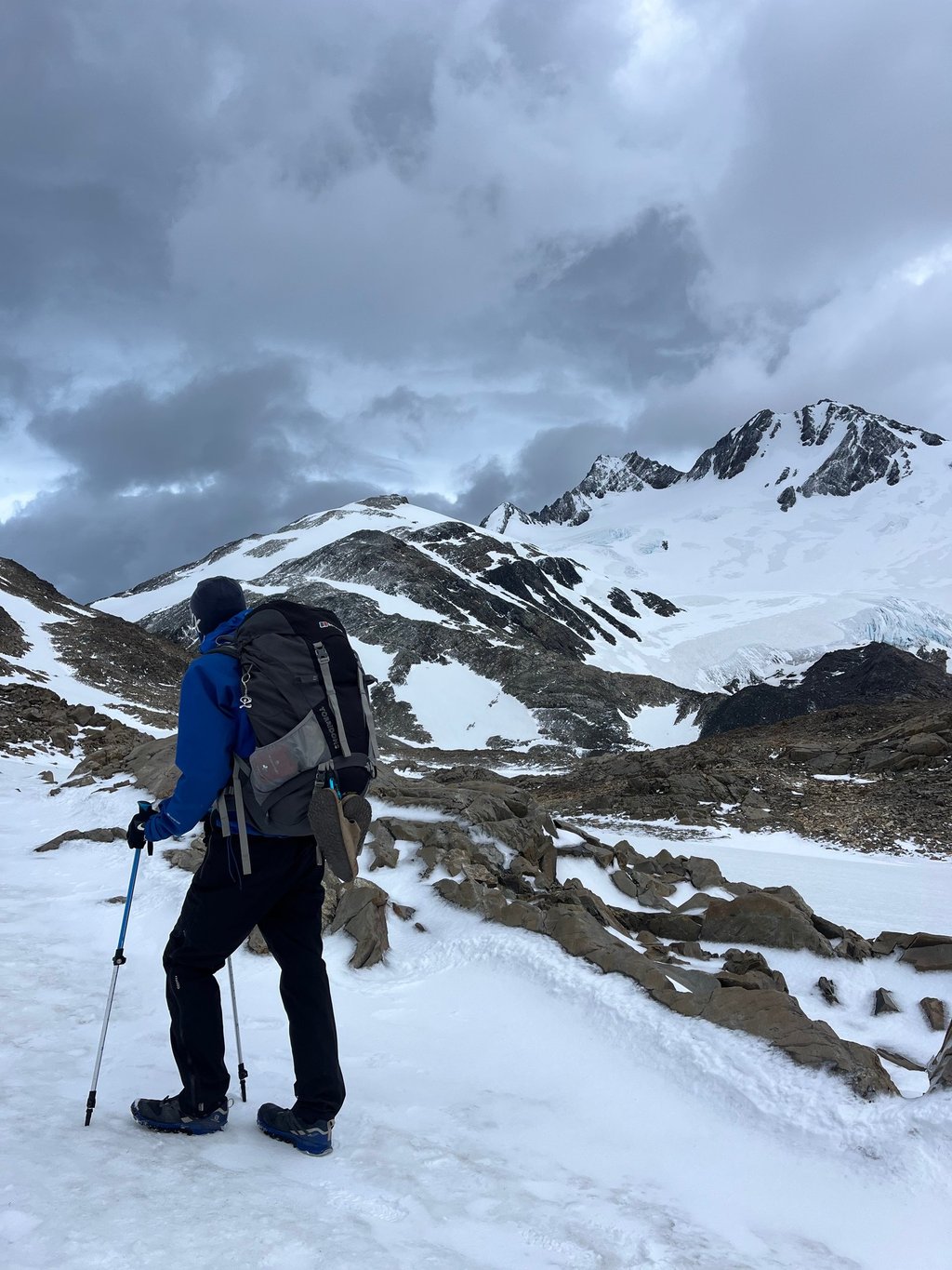
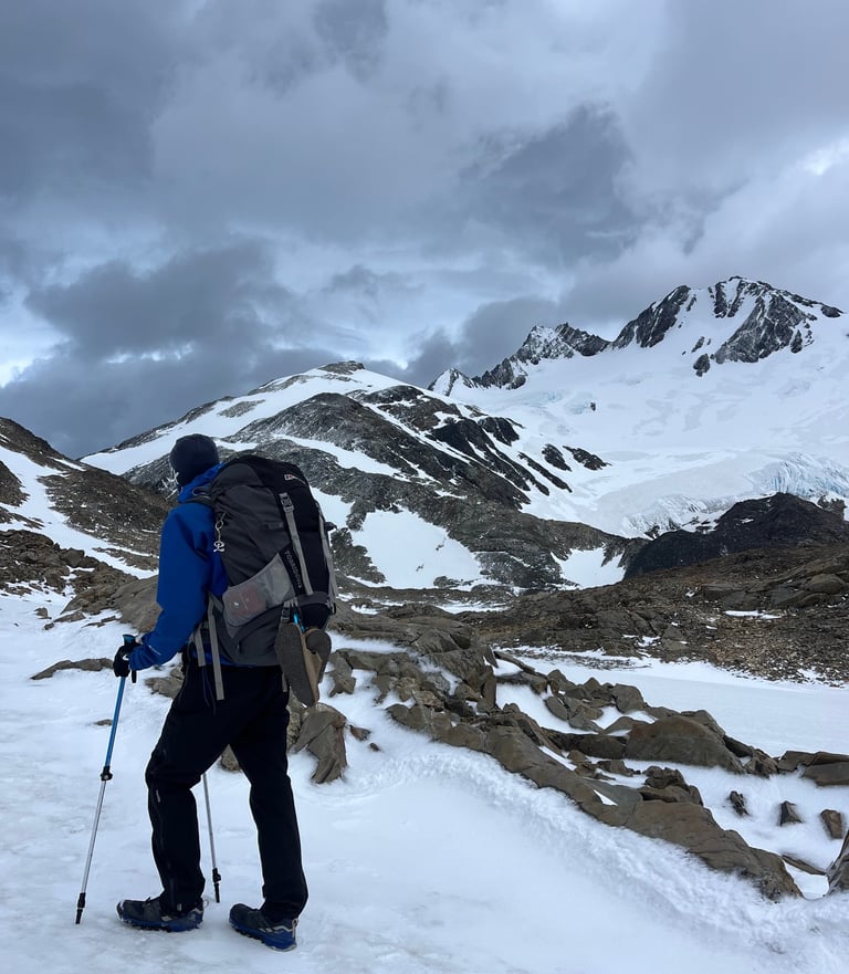
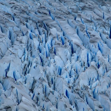
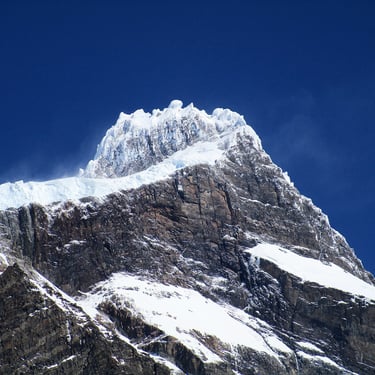
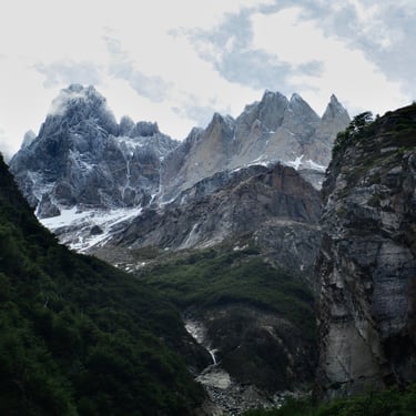
Again today wasn't too challenging. 13km with 500m of gain. Early on we spotted a huge glacier in the distance. This was today's goal. Los Perros Glacier. It is located around 500m from tonight's campsite.
The trails on day 3 were so nice, weaving through trees, crossing bridges over rivers, it felt so peaceful. We saw a nice area to stop by a river for lunch. It seemed as though every time we stopped to look around, the views were getting more and more incredible. This became a theme over the coming days. Another sandwich and knock off snickers down and we were on our way to the glacier and the campsite.
The final section towards the glacier viewpoint is very rocky. Definitely ensure you're putting your feet in the right place here because a sprained ankle this far from any exit points wouldn't be much fun. Horses can access these areas, but that would still take a long time. Helicopters can also reach this area in an emergency.
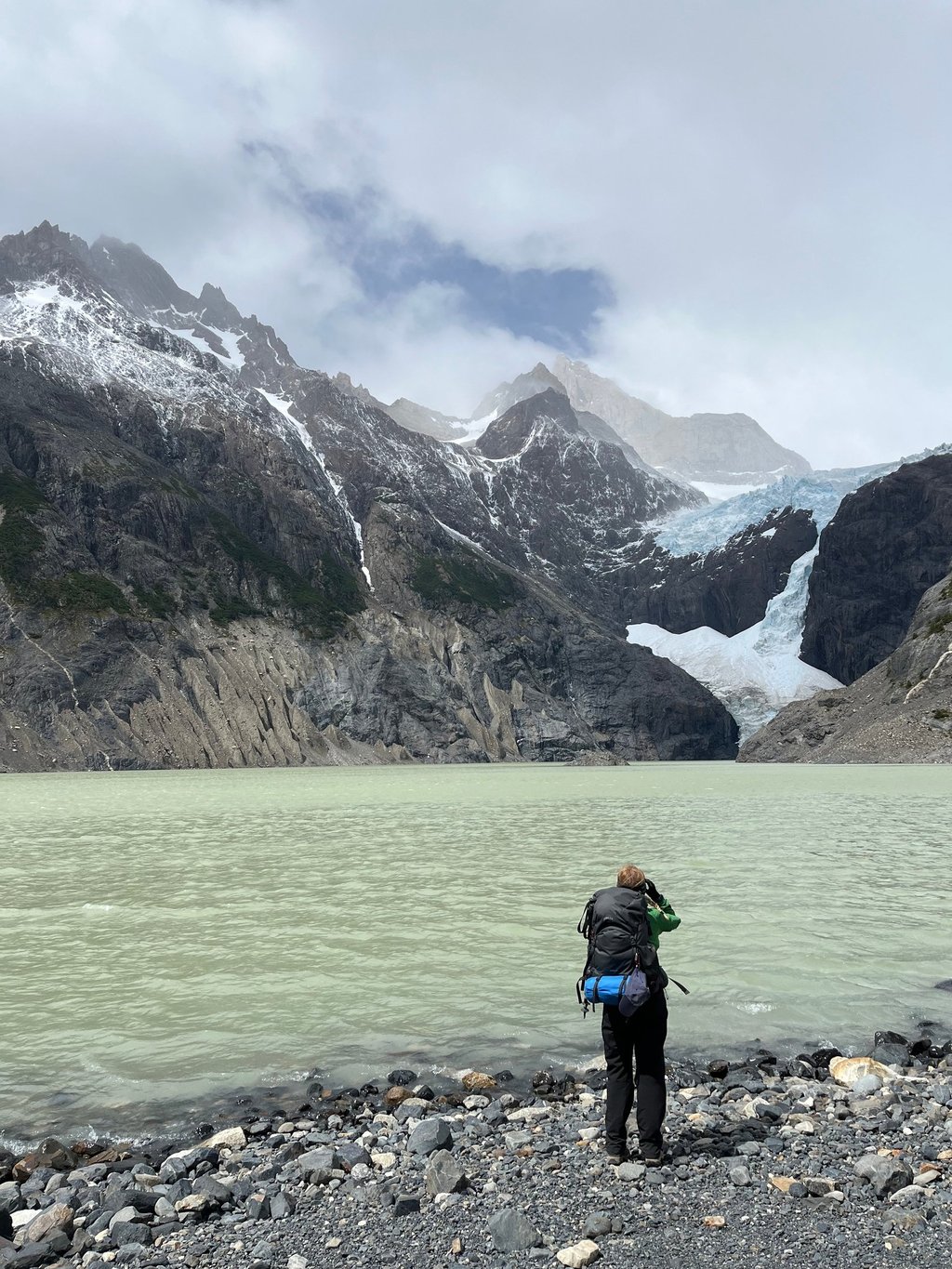
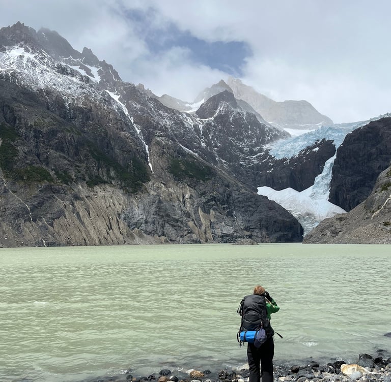
When we reached the viewpoint, it was only Rose and I there. The photo above, and any photo online doesn't do justice to the pure scale of the glacier and surrounding mountains. They absolutely tower over you. It's pretty exposed to the elements by the lake, with some strong winds and eventually snow later on. We took it in for a while before heading to the campsite.
I had to get an update on the Man United score, they were playing Tottenham and I'm pretty sure they lost. But the staff were kind enough to put it on their monitor using the Starlink. Certainly not the best use of my time whilst being in one of the most breathtaking national parks on earth, but you've got to do what you've got to do.
Day 4 (Los Perros to Grey)
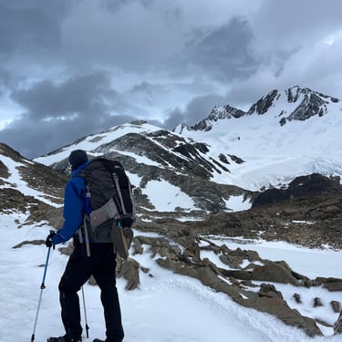
Today was the big day. The John Gardner Pass. This is the most exposed section of the O Circuit. It is known to get very windy on the pass, and with a long and steep downhill section, our knees had to be ready. They recommend trying to get up and down the pass early, as the weather tends to be better earlier in the day.
4:30am alarm it was then. Up nice and early, take down the tent, go and make some porridge and then head off. We had become used to waking up at this time, starting to feel like a nocturnal animal. It somehow felt alright though, if I ever tried to wake up at home at this time I'm not sure it'd be possible.
5:40am and we were off, ready to tackle the John Gardner Pass. Los Perros campsite is located at around 550m altitude, with the high point of todays hike at 1200m. A decent amount of climbing in around 6km, with the last section towards the pass crossing some quite deep snow. Our trekking poles came in pretty handy here.
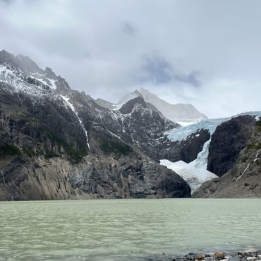
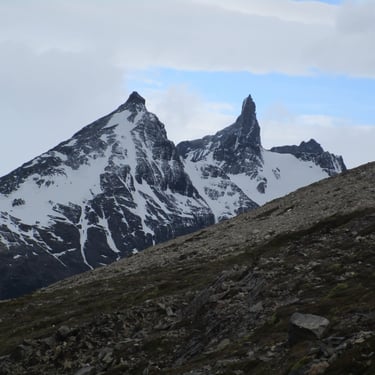
At around 8:15am we reached the pass. From here, you are treated to panoramic views stretching north into the Southern Ice Field, with the Grey Glacier cutting through the valley below. To the South, views across Lago Grey into huge snow capped mountains in the distance. We had to sit and take this in for a few minutes. It was a special view. But it was freezing, so waiting around didn't seem like the best idea.
Off we went, with around 1200m of descent until we reached Campamento Grey. With 15kg bags on our backs, and already having put 50km into the legs over the previous days, our knees had to be strong. We were very lucky with the weather, it was very cold, but there was almost no wind. It was a steep downhill, taking around an hour to reach the bottom, at 500m altitude, with gradual rolling ups and downs from here on out to the camp site. A really scenic stretch with expansive views of the Grey Glacier for almost the whole way. A quick break to have some water and a snack at the Paso ranger checkpoint, there to ensure everyone comes through from the pass, and we continued on. For lunch we scrambled up to a viewpoint overlooking the Grey Glacier in awe of the unimaginable scale. Photos can't do it justice (again).
Each day the views were getting better and better, it was like nothing I had ever seen before. Between our lunch spot and the campsite we had to cross two suspension bridges. Looking to the left whilst crossing these gives you views of the most dramatic mountain landscapes I have ever seen. These are accessible if you are doing the W Trek too, so I would 100% recommend coming up here from Refugio Grey to explore this area.
After a tiring day, we reached the campsite at around 2pm, set up our tent, had a warm shower and then a well earned nap. It had been by far our favourite day of hiking so far. It felt like another world. We treated ourselves to a pizza and a beer with some people we had met previously, and had a really nice chat with them whilst we ate. You could feel the distinct difference in numbers here. From at most 80 on previous days, it had become a few hundred.
Day 5 (Grey to Paine Grande)
We treated ourselves to a lie in (around 8am) and made some porridge, packed up and headed off around 9:15. It was quite overcast today, with some fog and rain making the conditions slightly unappealing. We weren't bothered by this though, as we had been incredibly lucky so far with clear skies and hardly any rain.
11km and 300m of elevation gain meant a nice easy day ahead, which was needed after some longer distances and big elevation gains the previous days. Along the trail, you are treated to views up towards Grey Glacier over Lago Grey, gradually disappearing further into the distance. These views were slightly limited today with the fog, but we weren't going to complain.
The trails here were becoming busier, with traffic going in both directions. If you are reading this whilst planning to go and do either the W Trek or the O Circuit, please say thank you if someone stands to the side to let you through. Or at least acknowledge their presence. Maybe I'm just too British. I did have to drop a 'your welcome' a couple of times to people who just walked past whilst we'd been waiting about twenty seconds to let them through. So intimidating.
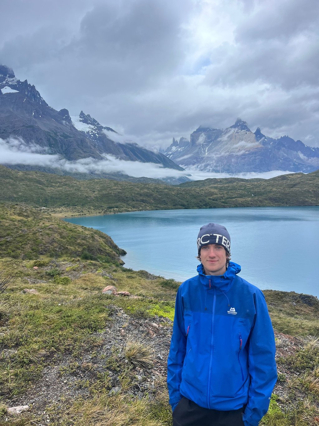
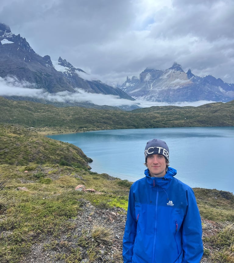
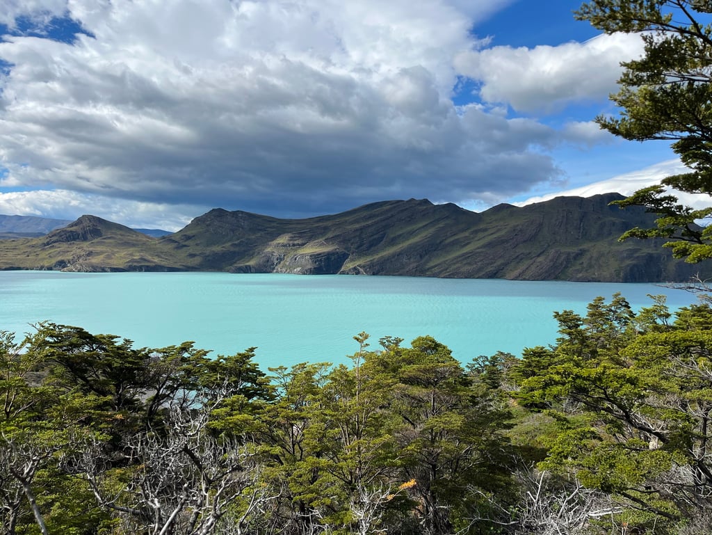
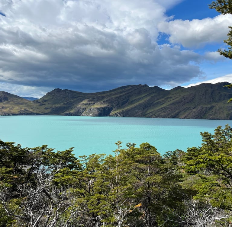
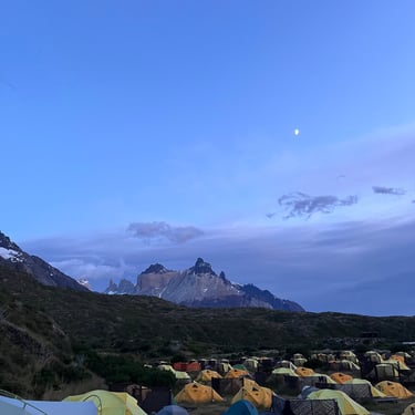
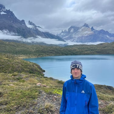
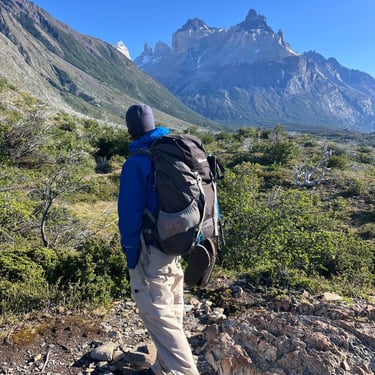
After 2-3 hours we made it to Paine Grande campsite. Located next to Lago Pehoé, Paine Grande campsite has a large area set up for pitching tents and pre pitched tents, indoor areas for cooking, and refugios for a more luxurious sleeping arrangement. Views of the Paine Massif tower over to the North-East tower over the camp, making you feel tiny.
From the campsite, you can follow a trail around 1km up along the west of Lago Pehoé (pictured) for incredible views of the Paine Massif. The following morning I came up here again for sunrise which was spectacular. We only saw a handful of other people up here too, a peaceful spot in an area full of trekkers.
Day 6 (Paine Grande to Frances)
With 22km and almost 1000m of elevation gain, we had a big day ahead. Starting early to try and beat the main crowds, we made some oats, packed up and left by around 7:30.
Campamento Italiano is the start of the Valle Francés. It is an old campsite that is no longer used, but serves as a resting point before tackling the incline up to Mirador Francés and Mirador Britanico. Most people choose to leave their big bags here, and just carry some water and some snacks up to the viewpoints. We did this and our shoulders really appreciated the break. It felt like we were flying.
From Campamento Italiano it is a consistent, steep uphill 5.5km all the way up to the Britanico viewpoint. Around half way you will reach the Francés viewpoint, with dramatic views of the French Glacier and Cerro Paine Grande. If you wait around here, you are likely to see shards of the glacier calve and tumble down the mountain into the valley below. This is a spectacle to see, but to think that in the not too distant future, it might not be there is deeply worrying.
We continued on to the high point of today's trek, Mirador Britanico. As you get further towards the viewpoint, the trail starts to flatten off after leaving a forested area, and you are within touching distance. A final scramble up some steep rocky terrain and you are treated to 360º views of granite spires. It really is something else. Distinct layers of rock cutting horizontally through the formations make you question how these formations came about in the first place.
After taking in the views we returned downhill, stopping at the Francés viewpoint again, before going back to our bags at Italiano. Francés camp is a couple of kilometres from here, where what sounded like thunder continued through the night. But it was actually the glacier calving.
Tip: Wake up and leave early to beat the main crowds to the main viewpoints. They are still likely to be busy at most times, but the earlier you get there, the quieter it is likely to be, and the better the weather is likely to be.
Day 7 (Frances to Chileno)
Today consisted of 16km and 800m of elevation gain, following the shores of Lake Nordeskjöld before heading up the Ascencio Valley to Chileno Camp. The turquoise of the lake is otherworldly with dramatic mountain landscapes surrounding.
After this flat section, you will reach the base of Almirante Nieto before a series of steep ascents commences. We stopped for lunch here before tackling the inclines. After the previous days the views weren't quite the same, but still like nothing I had seen previous to this trek. It's strange how you can adjust to the seeing landscapes like this so quickly, and it starts to feel normal. It really shouldn't feel normal.
I would recommend staying here rather than Central for a shorter route to Mirador Base Torres for sunrise the following morning. It will save you 6-7km, so you can start hiking at 4am rather than 2am (in December at least).
We made some dinner and went to sleep early, ready for the early morning alarm.
Tip: All the trails are well marked and easy to navigate. However, it is definitely worth having a GPS map dowloaded in case. Weather can be very unpredictable so having a backup in case conditions get bad is essential. We used this All Trails Map.
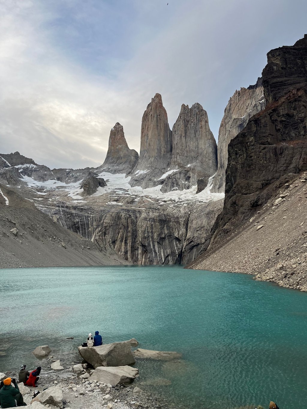
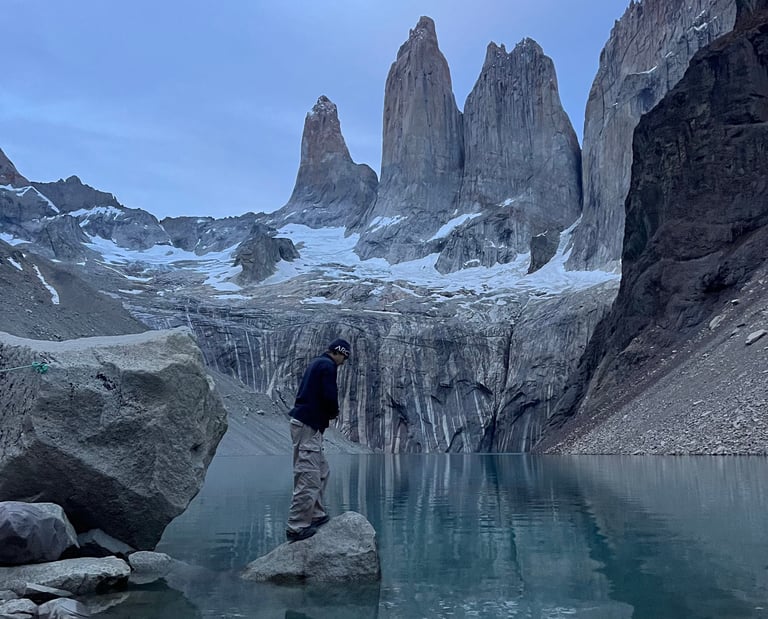
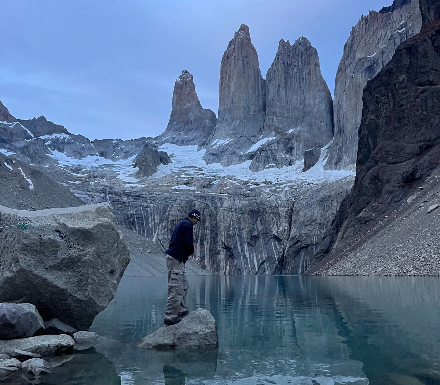
Day 8 (Chileno to Mirador Base Torres)
Christmas Day, 2024. So our alarm went off soon after 3am, and we got ready to leave. The only time I would have woken this early on Christmas was if I was going to see if Santa had been. You can leave your bags in the restaurant area whilst you hike up to the mirador and back, where there were coffee machines and cereal. I’m not entirely sure if you are allowed to indulge in these if you haven’t paid, but there were no staff there at that time, and after probably not eating enough food over the previous 7 days, some coco pops and hot drinks went down a treat.
We were fuelled and ready to tackle the remaining 5km, with around 500m of elevation ahead of us. Headtorches on, we started walking through the early hours of the morning, with the first half being a nice gradual incline. As you get higher, the terrain starts to change. Going from forest out into exposed, rocky ground. Naively, we were following the people in front us who must have missed the turning along a maintained trail up to the lake. We ended up having to scramble over boulders and loose scree for the final 1-2km, which was actually really fun. We joined onto the path again and were almost there.
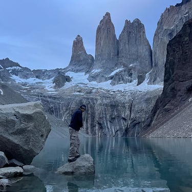
Sat by the lake, we looked up at the famous ‘towers’ that the national park is named after. When the wind dropped, they reflected in the lake like it was a mirror. The sun rose around 5:30am, and although we didn’t get a golden glow on the granite towers, it was still a magical moment. There’s worse ways to spend Christmas Day.
After taking it in, we returned to back to Central, wishing people hiking the opposite direction a 'Merry Christmas'. We had some time to wait before our bus so we sat and ate our final snacks, reminiscing on our first multi day trek. It had been such an incredible experience. We couldn't wait to get back to Puerto Natales and make a spicy chicken and salad baguette. In our starving evenings after not eating enough pasta, we talked in length about what we couldn't wait to eat after. We came to the conclusion that a a spicy chicken baguette was what we had agreed on.
After the two hour bus journey back to Puerto Natales, we were disappointed to discover, as it was Christmas Day, all of the shops were closed. If only we had thought of that. There was one tiny shop, selling some quite minging looking vegetables, eggs and a few other bits. We salvaged what looked edible and planned to make some scrambled egg. There was a small Italian restaurant open too, so we went and got a Lasagna. 6/10 at best.
We went back to our hostel and called our families, looking at their Christmas dinners that we weren't at all jealous of. We had probably seen a nicer view this morning though. So we couldn't complain.
Feeling Inspired?
Let’s turn that dream into your next checkmark. Claim your FREE W Trek Itinerary & Info Pack today. We’ve mapped out every turn, every campsite, and every view so you don't have to. Enter your email and let’s get your trek on the books!